The city of Las Pinas did it before by building the Zapote River Drive—a 15-kilometer road project linking Daang Hari Road in Muntinlupa to the Cavitex Toll Road in Las Pinas by following the meandering Zapote River and enabling motorists to bypass the perennially congested Alabang-Zapote Road. Along with the construction of the two-way river road, Zapote River was dredged, cleared of rubbish, and rehabilitated to mitigate flooding during the rainy season, and to stimulate livelihood programs along its banks.
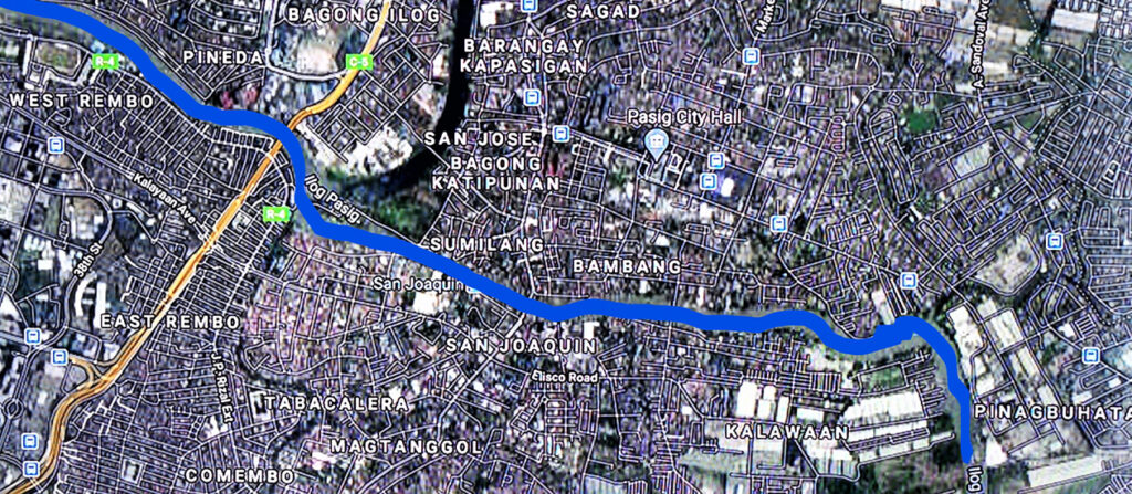
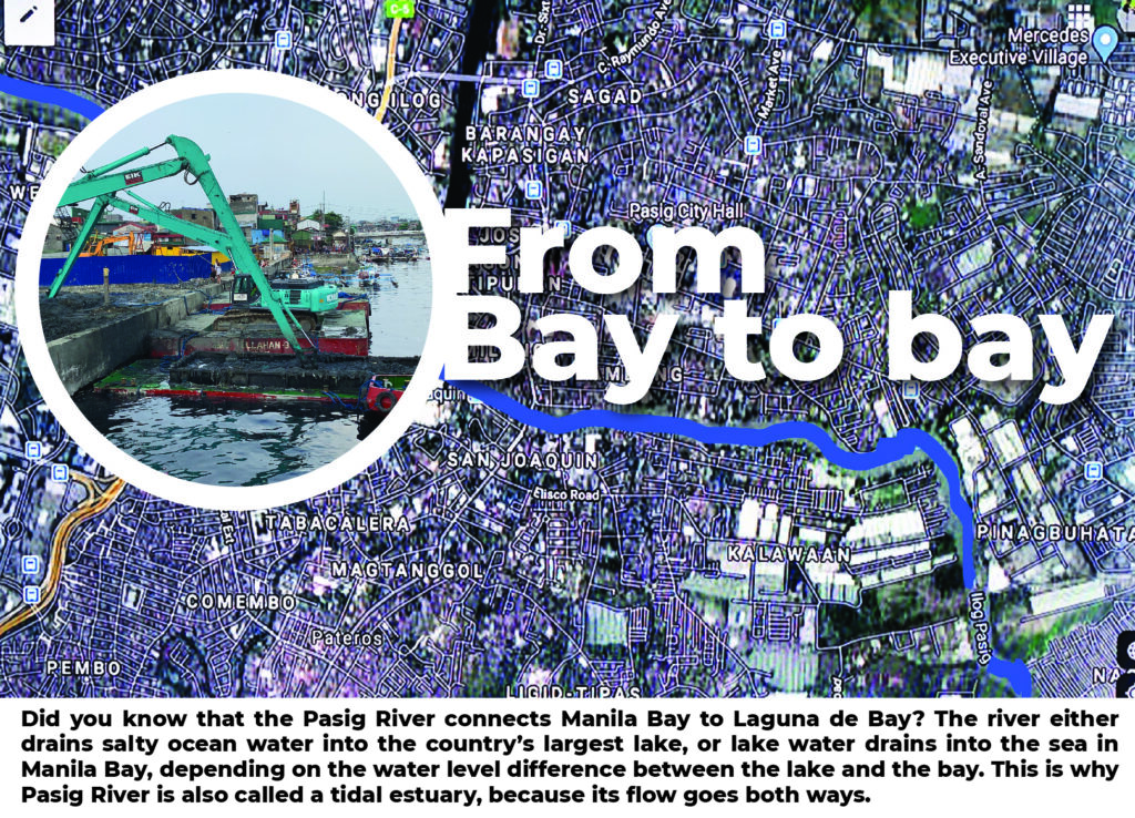
Now comes a much more ambitious plan to rehabilitate the 25-km Pasig River and build an elevated expressway alongside arguably the country’s most historic, most celebrated, yet most polluted waterway.
It’s an undertaking that probably only the government or the country’s largest company can take on.
It seems the latter has taken on the challenge. Pasig River may finally have a real shot at a total makeover, if the P95.40-billion plan by San Miguel Corp (SMC) to build the Pasig River Expressway (PAREX) passes the ongoing government review.
SMC president and COO Ramon S. Ang said that the PAREX project represents a “solution within a solution”—a means to solve Metro Manila traffic, with minimal disruption on existing cities and roads, with a built-in solution to clean up and improve the flow of water throughout the entire length of the Pasig River.
“Of all the projects we have done, this will perhaps be among the most challenging, and at the same time, the most fulfilling. Not only will we be building a much-needed direct link between eastern and western Metro Manila, but we will also be leading a historic effort to bring the Pasig River back to health,” he added.
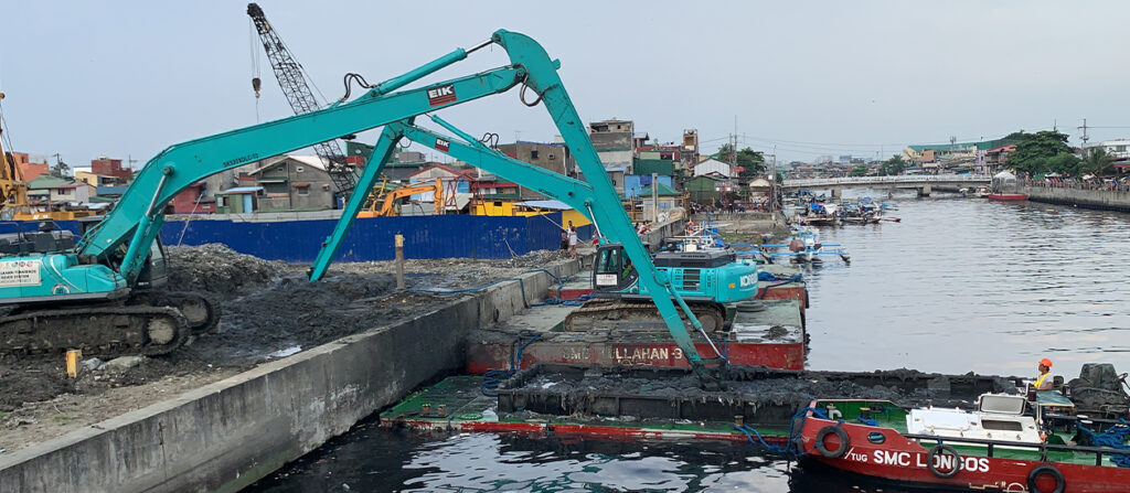
Ang explained that to build the 19.40-km, 6-lane elevated expressway along the banks of the river, the river bed has to be dredged and cleared of decades of debris and garbage to attain its optimum depth and ensure the constant flow of water. This, he added, will also help address flooding in Metro Manila.
The Pasig River Expressway, which will start from Radial Road 10 (R10) in the City of Manila and end at a connection to the South East Metro Manila Expressway (SEMME), otherwise known as Circumferential Road 6 (C6), is seen to reduce travel time from Manila to Rizal to just 15 minutes.
From R10, or the port area, it will have entry and exit points at the University Belt area, San Juan, Buendia, Mandaluyong, Makati, Rockwell, Edsa, Pioneer Street, Bonifacio Global City, C5, before terminating at C6.
It is seen to provide an alternative and faster access to the country’s largest business districts—Makati, Ortigas, and BGC.
The project is under a proposed built-operate-transfer (BOT) scheme for a concession of just 30 years, after which the government takes over the vital infrastructure assets.